| Mount McKinley, Alaska 20,320 feet |
Visited 6/9/2001 |
Our first view of Mt McKinley was dramatic. When we drove up to Denali National Park from Anchorage with Evelyn's parents, it was raining and the clouds were so low we could barely see the trees on the side of the road much less the mountain. The next day was thankfully clear for our visit to the park. We had been riding the shuttle bus along the Denali Park Road for a couple of hours, admiring the wildlife and wide expanses of tundra. We knew The Mountain was somewhere ahead of us, but we couldn't see over the nearby ridges. Is that it? Would we be able to see it at all? It is frequently obscured by heavy clouds. Is that it?
We came to the top of the ridge at Mile 53 and suddenly there it was. There was no mistaking its massive white bulk. The sky was perfectly clear apart from a few clouds about halfway up the mountain that served to enhance the drama of the view.
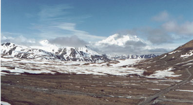
First view of Mt McKinley from the Denali Park Road
As we continued down the road, the clouds began to gather quickly. By the time we reached the Eielson Visitor Center, the mountain was already partly obscured. We were scheduled to fly out of Talkeetna to land on the glacier tomorrow at about this time: would we be racing against the incoming clouds?
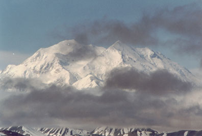
Mt McKinley from the north, towering 20,320 feet
The next day we could see the mountain clearly all through our drive south to Talkeetna with John and Sonia. We checked into our hotel and marveled at the perfectly framed view of Denali from our rooms. We ate lunch in the hotel dining room, with Mike looking nervously out the window for any sign of wet-blanket clouds.
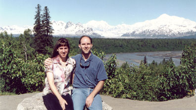
Sitting sweetly with the southeast slope of Mt McKinley
Evelyn's parents drove us to the Talkeetna Airport. We checked in and crammed ourselves into the little Cessna with our pilot and another couple. The pilot started the engine, which buzzed like a glorified lawn mower. We taxied out to the runaway and took off.
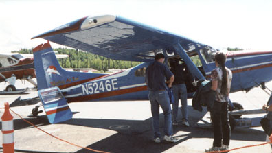
Climb aboard for the grand Denali tour!
The view was immediately interesting as we flew over the braided channels of the Chulitna River. Soon we reached the edge of the glacier. The glacial ice formed many fascinating textures, and rock spires thrust up steeply from the nearly flat valleys. The massiveness of the valleys and mountains was not apparent until we saw the specks of an expedition down on the ice.
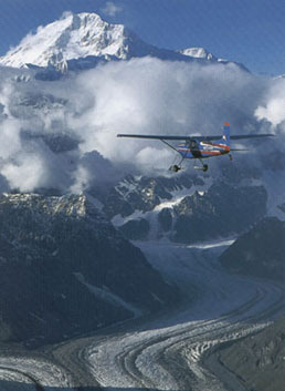
Flying towards Mount McKinley
We flew over the Kahiltna base camp area at 7,200 feet and saw several climbing parties on the ridges above the camp. We flew past Mount Foraker (17,000 feet) and Mount Hunter (14,573 feet), then circled around the summit and headed straight for the Wickersham Wall, its 14,000 feet of uninterrupted drop being the steepest continual vertical relief in the world.
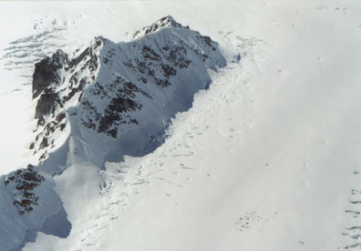
Flying over Kahiltna Base Camp which is 7,200 feet.
The tiny specks near the bottom right are climbers.
We landed on the Ruth Glacier near the Don Sheldon cabin. We had great views of Mount McKinley behind us, Mooses Tooth ahead of us, and other spectacular mountains all around. The weather was still beautiful; we walked around on the glacier without our coats on.
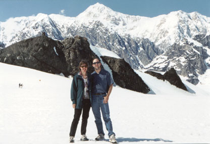
Mt McKinley's landscape is so massive we can't tell distance.
The rock behind us is 1 mile away. Notice the tiny people to our left.
Mike rode in the front seat on the return flight and noticed that the plane had the same CD player as his car! The flight back to Talkeetna was just as spectacular as the flight in had been. Nonetheless, we were happy to get back to the hotel in one piece, no mishaps and no airsickness.
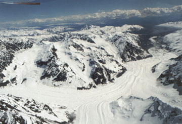
As the glaciers meet, they don't merge.
Each river of ice stays separate.
Climbing Mt McKinley is in an entirely different league from any of the other state highpoints. By many measures it is more difficult than climbing Mount Everest, due to its massive bulk and far northern location. Therefore, we are making an exception and counting our visit to the flank of the mountain as completing the highpoint. Perhaps by the time we complete the other 49 states they will have built a tram to the top of Mt McKinley.