| Mount Whitney, California 14,494 feet |
Climbed 9/9/1994 |
We climbed Mount Whitney with an expedition that included Evelyn's parents (John and Sonia) and Mike's brother (Jim). Mike and Jim had climbed Whitney once before, in a quick strike soon after Jim returned from Outward Bound. (Ask Mike or Jim for the story of the mouse in the cookie bag, which is a fine corrective for any macho feelings they might have about making the climb in one day.)
Mount Whitney is the highest point in the contiguous 48 states. It is eleven miles from the Whitney Portal trailhead to the summit, making the mountain relatively accessible and the hike among the most popular in the country. To camp along the trail during the summer, you submit a request in the spring and hope for the best in the lottery. Without a permit, your only choice is to attempt the climb in a single day, starting well before dawn and finishing well after dark. We were lucky enough to get a camping permit for our first choice of dates, perhaps because it was a bit later in the season.
The Sierras rise suddenly and steeply from the Owens Valley. We drove from Lone Pine to the Whitney Portal along a straight, flat road through the brush. We finally gained some elevation in the final mile or two. Whitney Portal is at 8,360 feet — meaning that the hike gains 6,100 feet over 11 miles. In a word: steep.
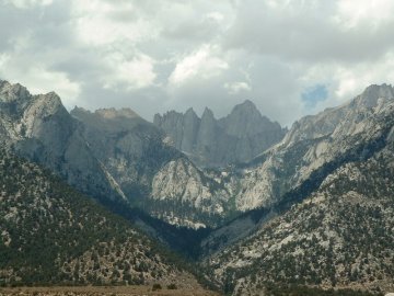
Mount Whitney from the access road
We began hiking at 8:00 in the morning. Our target for the day was Trail Camp, located six miles in at 12,000 feet, just below the final set of switchbacks to the ridge crest.
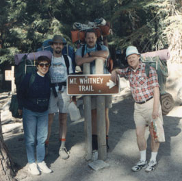
Happy hikers at the start of the trail
The first few miles of the trail were pretty — trees, streams, meadows, granite — and we were fresh enough to enjoy the scenery. Strenuous hiking took its toll quickly enough, however. We were all sweating in the heat of the sun. Trail dust stuck to our skin and dried our mouths. John and Sonia were carrying daypacks without waist belts, so they walked with their hands behind their backs trying to lift the load from their shoulders.
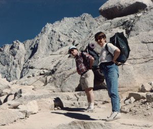
John and Sonia have to support their loads
because their day packs have no waist belts.
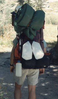
The tinkerer comes to town:
Jim's pack towers with the additional load.
By the time we reached Outpost Camp (10,365 feet, 3.5 miles in), Sonia was suggesting that perhaps we should camp there instead of continuing for 2.5 miles more to Trail Camp. She and John could travel faster without packs, so we could make up the time tomorrow. Despite everyone's obvious tiredness, Mike insisted that we continue. He knew that we wouldn't make the summit if we didn't get as close as possible before camping.

Mike and Jim cross over to Bighorn Park
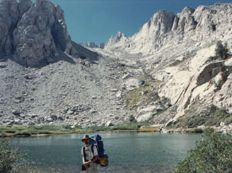
Mirror Lake
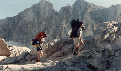
Evelyn and Jim plod up the trail
We finally arrived at Trail Camp in the late afternoon. We found a spot next to a large boulder in an attempt to get out of the wind that blew down from the ridge. We gratefully dropped our packs, pitched our tents, and noted the rapidly dropping temperature. We cooked Kraft macaroni and cheese for dinner, but it was cold before we could finish it. For the rest of the evening we stayed in our tents and sleeping bags listening to the wind.
The air was quite brisk the next morning, with cludy skies. We got moving as quickly as we could, leaving our camp set up. We could strike it on the way down when it was warmer. From Trail Camp, the trail starts up a section known as "the 97 switchbacks." For over two miles, we cut back and forth across the steep slope leading to the top of the ridge. In that two miles we gained over 1500 vertical feet. Despite our light load compared to yesterday, it was slow going, so we were not warming up as we usually would with exercise.
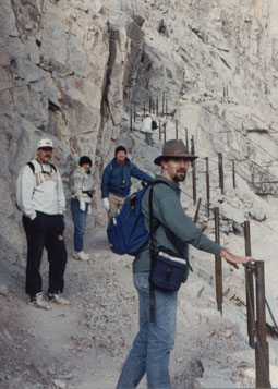
So cold: notice the socks on hands,
because we had no gloves.
The view from Trail Crest is spectacular. Suddenly you can see the Sierra range spread out for miles to the west. You are overlooking the mountains of Kings Canyon National Park. However, if we thought the wind was biting on the eastern slope, it was even more punishing at the top of the ridge. We did not admire the view for long.
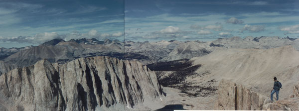
Mt. Hitchcock, the Sierras, and Sequoia National Park
The good news was that the final two and a half miles to the summit were comparatively flat: only 800 feet of elevation gain. The bad news was that the trail followed the top of the windy ridge. We were not at all dressed properly for the conditions; we were dressed for the hot hike of the day before. Evelyn had nothing more than a sweatjacket; Mike was wearing a long-sleeved cotton shirt. (Where was that Outward Bound training when we were packing?) John and Sonia had warm clothes, but even so they resorted to wearing socks on their hands as mittens. Some of us were feeling the elevation too, so that it felt like the wind was taking our breath. Every few hundred yards we stopped and silently turned our faces to the rocks, backs to the wind. Evelyn started worrying that we'd all end up with hypothermia.
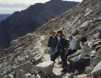
Feeling the cold and the altitude
When we finally reached the summit, we quickly ducked into the hut. It wasn't any warmer in there, but it was out of the wind. We took turns stepping out to take pictures of the views and the summit marker.
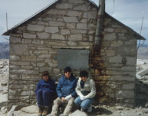
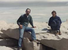
Summit hut, and freezing, windy summit
We didn't spend long at the summit. On the way back down to Trail Camp, all feelings of altitude sickness were forgotten, as was the slow pace. Jim and the Knowles' moved down the trail so quickly that Mike and Evelyn couldn't keep up. The quicker movement helped us finally warm up.
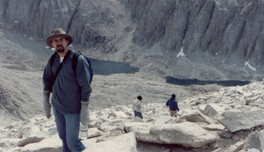
Scurrying down the mountain, trying to get warm.
At our campsite we found our tents blown back against the rocks. One of the poles in Jim's tent had snapped. Since it was only mid-afternoon, we decided to pack up and head lower. As we hoped, the wind died down as soon as we got below treeline.
As the sun started to set behind the mountain, we met up with a guy who had lost the rest of his hiking party. It was clear that he wasn't going to make it to the trailhead before dark and he had no flashlight. He asked if he could stick we us and we agreed to let him despite Jim's nervousness about it. With the last of the daylight, we found a clearing and pitched one of the tents. Mike and Jim slept in their sleeping bags under the stars. We let our straggler borrow the rain fly to wrap himself in.
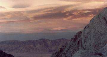
A beautiful end to the second day
The guy was gone by the time we awoke at dawn the next morning, leaving the rain fly rolled up next to the tent. We walked the short distance to the trailhead, chattering about the adventure and the accomplishment.