| Mount Elbert, Colorado 14,433 feet |
Climbed 6/30/2000 |
In late June 2000, Evelyn and I set out to climb Mt Elbert together as part of our state highpoints project. I had climbed Mt Elbert in July 1982. During my second course through the Colorado Outward Bound School, we climbed 9 fourteeners in seven days.
Evelyn and I drove into Leadville from the south. I remembered the drive between Buena Vista and Leadville as very scenic, with the Collegiate Range mountains rising sharply to the West. I was looking forward to sharing it with my wife. On this day, however, it was raining and the cloud cover was down around the tops of the trees. We could see the signs pointing toward Mt Princeton, Mt Harvard, and so on, but they simply pointed off into the fog. Very disappointing.
When we pulled into the outskirts of Leadville, I was immediately struck with a dropping depression. The city looked exactly as I remembered it: small cottage-like houses mixed with mobile homes, streets that trailed off to dirt a few blocks from Main Street, businesses in run-down old mining buildings. When I was here last, I was just out of high school and felt extremely homesick as I got off the bus and made my way to what is now the Super 8 on the edge of town. I even wrote a story about my visit, in which I was depressed by the poverty of the town until I looked up and saw the surrounding mountains. With the weather today, this remedy was unavailable.
We stopped at a sporting good store downtown to buy a day pack for Evelyn. Given the weather, we also picked up some polypro shirts. We waited for the proprietor as he sold a guy a fishing license. He said the weather report called for this inclement weather to continue through Thursday (this was Sunday). We bought our stuff, then went to Pizza Hut (so we would have leftover pizza for the climb). Over lunch, we pondered our options. Evelyn was quiet, but I could see in her face that she was imagining a cold, wet climb with no view to compensate us for the effort. Or maybe the weather would clear!...but probably not. I consulted the map and our itinerary, and decided we could make a fairly straightforward swap of hotel rooms: tonight and tomorrow for Thursday night and Friday night, when we were scheduled to be in Grand Junction—on the dry side of Colorado. I called to cancel our room for that night and made reservations for Thursday and Friday at the Columbine Inn next door to the Pizza Hut. We continued on to Grand Junction. I spent the next few days obsessively watching the weather reports.
We returned to Leadville on Thursday, coming over Independence Pass from Aspen. The weather was much nicer: sunny and clear except for the usual afternoon thunderstorm. I felt much better about Leadville too, especially after enjoying a nice dinner at an unexpected Chinese restaurant and browsing the impressive magazine selection in the local book store.

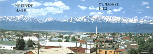
Leadville, 10,200 feet
Our original plans called for us to stay in a hotel in Twin Lakes and follow the South Elbert Trail. Since we ended up staying in Leadville, we switched to the North Elbert Trail. On Friday morning, we headed out fairly early for the trailhead at Halfmoon Campground. We started the hike at almost exactly 7:00 AM. The first part of the hike, along a section of the Colorado Trail, took us through relatively uninteresting forest terrain—very little in the way of underbrush. Quite soon we reached the fork for the North Elbert Trail, which headed up fairly steeply through more of the same. In no time, it seemed, we were nearing treeline at 12,000 feet and looking at the summit right above us. Were we really making such good time? Evelyn was setting an excellent pace, as always: not too fast, but consistently brisk.

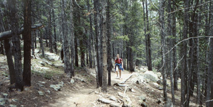
Evelyn sets the pace
From my previous trip up Elbert, I remembered a series of false summits. As we cleared the trees, though, I looked up and thought we couldn't be looking at a false summit because Mt Elbert from a distance has nice clean ridge lines to its summit.
The trail got steeper. What else could it do, gaining as it does almost 4500 feet of elevation in less than five miles? And what else could we do except slow down our pace and enjoy the views?

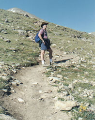
Mike rests with false summit ahead
About half way up the "summit" I finally realized how it could look so much like the real thing when the Elbert skyline doesn't show it. We were coming up the ridge that stretches out toward Leadville, so the bumps along the way fade visually into the mass of the mountain. The dream of a quick summitting faded away as we came around the back side of the knob. We could see the trail up higher on the ridge now, leading to what I was now sure was a second false summit. We slogged our way up. As we reached the second false summit, we could see the snow on the face just below the actual summit.
Just before the summit, our trail met up with the South Elbert Trail. We could see a few people coming up that way. At the summit cairn, we found two guys who had brought their dogs with them. One of them was nice enough to take our official summit picture—with a couple of different cameras. I checked my watch: it was around 11:15, which meant it had taken us a little over four hours to reach the summit.

5 miles, 4.500 ft elevation gain, 4 hrs
We spent about 20 minutes or half an hour at the top, having a snack and petting the dogs. We looked off to the west and saw the afternoon clouds collecting over there. We congratulated ourselves on our early start and the change of days, then headed back down, watching the clouds come in over the summit. We met a number of groups still on their way up. As usual, the hike down seemed longer than we remembered from the hike up, especially the portion below tree line.

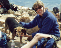
Evelyn makes a summit dog buddy