| Granite Peak 12,799 feet | Visited 8/30/2011 |
Granite Peak is hidden in the heart of the Beartooth Mountains, not even visible until you've hiked several miles from the trailhead. The route description tells the story of its legendary bad weather: hike across the Froze-to-Death Plateau to a high camp just below the summit of Tempest Mountain. The final section of the climb involves a decent amount of exposure and a bit of Class 5 technical climbing. In a word, it's a challenge. We hired a guide and a porter to assist us on our final Western peak.
We met Lisa (our guide) and Andy (our porter) at the West Rosebud trailhead at 8:00. We did a gear check, and Lisa persuaded us to leave a bunch of clothing — and weight — behind. "If you can't wear it all at once, don't carry it. You don't need a change of clothes for a short four-day trip." We trusted her judgement, swallowing our concerns about body odor and a place named "Froze-to-Death Plateau."
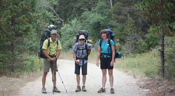
Andy, Lisa, and Evelyn set out
We set off in shorts and T-shirts, dressed for the warm weather instead of the intermittent raindrops. The trail worked its way slowly uphill alongside West Rosebud Creek, whose rushing water had the beautiful blue-green color of a well-aerated mountain river. After a couple of miles we crested a saddle to a view overlooking Mystic Lake and its surrounding mountains. Mystic Lake is the largest lake in the Beartooth Mountains and a popular fishing spot. We ate an early lunch on the shore of the lake, and filled our water bottle in preparation for the climb to the Plateau, 2500 vertical feet above us.
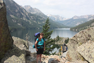
Overlooking Mystic Lake
The Phantom Creek trail starts steeply up out of the Mystic Lake basin. Through a series of switchbacks, we hiked for miles without ever losing sight of the lake far below. We kept up a good pace and pleasant conversation as we scaled the canyon wall. At around 10,000 feet of elevation, we reached a cairn that marked the top of the ridge and the spot where we turned off of the trail onto the Froze-to-Death Plateau.
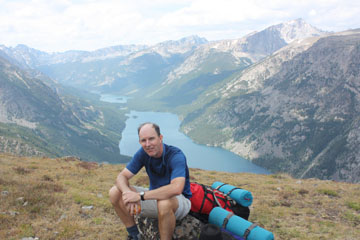
Mike rests at 10,000 feet
The Plateau is where Lisa started to earn her money. It's a wide rolling table of tundra and rock fields with nary a trail in sight. You can see multiple cairns on the horizon, but which one marks the correct route? Lisa lead us across the soggy ground for about a mile, arriving at a flat, dry spot with established rock wind breaks. Just above the campsite was a small snow field whose run-off was a perfect water source. We chose our spots and pitched our tents. We'd hiked about seven miles and gained 3500 feet, and we felt good about our general fitness and lack of altitude symptoms. Evelyn's hiking and Mike's running paid off.
We crawled into our tents as it started to rain. From inside, we heard the rain turn to hail and watched it bounce off the tent's rainfly. The storm passed over us fairly quickly, enabling us to have warm drinks and dinner outside of Lisa and Andy's tent. We watched the thunder and lightning to the southeast as we enjoyed our camp burritos. The rain and the wind returned overnight, but we cuddled cozily in our tent.
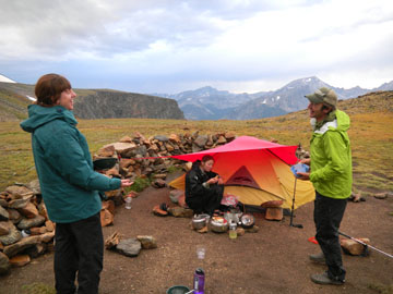
Dinner at Camp 1
The sun was out in the morning, shining on the mountains across the way. As we lounged in our sleeping bags waiting for breakfast, a pair of four-legged shadows passed across the wall of our tent. We unzipped the front flap to find mountain goats browsing around about 10 paces away -- exactly the distance Mike walked when he peed in the middle of the night. Mmmm, salt!
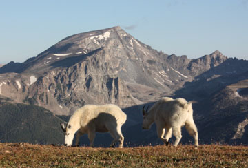
The friendly natives
The goats wandered around camp while we ate breakfast and started to pack up. When we went to the back side of a rock pile for our morning constitutional, one of the goats perched atop the rock pile to watch. When Mike started to pee, the goat licked his lips three times and started down the hill toward his reward.
We set off at mid-morning. The Plateau tilted upward toward Granite Peak, and the tundra gave way to boulder fields. Evelyn is not a fan of crossing boulder fields. She stayed right on Lisa's heels so that she could mimic her steps from rock to rock; Lisa must have felt Evelyn's shadow looming over her because at one point she turned and asked Evelyn how tall she was. After a couple of miles, we got our first glimpse of Granite Peak over the horizon. Not long after, the breeze picked up and we felt the first raindrops of the afternoon. We donned our rain jackets and picked up our pace. It cleared up soon after.
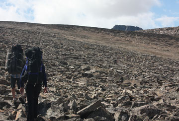
Our first peek at Granite Peak, beyond the Plateau
We set up camp at 12,000 feet, just below the summit of Tempest Mountain. We had a gorgeous view of Granite Peak just across the saddle; the route to the summit looked impressively steep.
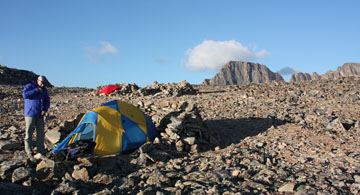
Camp 2, with Granite Peak just over the ridge
As on the previous day, snapping our tent's rain-fly into place was the signal the weather was waiting for. The wind picked up and brought rain clouds from behind Granite Peak. The rain turned briefly to hail, then carried on past us. For the rest of the afternoon, we had bursts of rain interrupted by interludes of mere drizzle. After a couple of attempts to gather for dinner al fresco, we ended up eating the beef and potato stew in our tent. The rain eased up after dinner, carried away by the increasing wind gusts. As we shared after-dinner drinks outside of Lisa and Andy's tent, we could hear the sound of freight trains coming over the ridge; when the gusts arrived they pushed against our backs. Mike never expected that he should have brought his hand-held anenometer.
We went to bed uncertain about whether the weather would cancel our summit attempt the next morning. The question turned out to be moot: Evelyn spent several cold sleepless hours during which she decided that she wouldn't tackle the steep and technically challenging route. We'd had a very enjoyable expedition so far; why ruin it with a cold and unpleasant climb to the summit? In the miraculously clear sky of morning, Mike pointed out that they'd be to the summit in less than three hours and back to camp by lunch time, but Evelyn stuck to her guns with the steadfastness that comes with all late-night decisions.
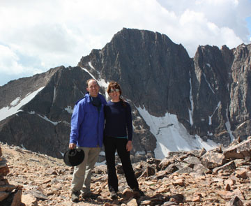
Granite Peak
So instead of heading to the summit, we started back toward the trailhead. Except for Andy—with his porter duties nearly over, he left to climb the peak by himself. By lunch time, when we would have just been getting back to camp, we were off the Froze-to-Death Plateau and on the trail. Little more than an hour later, Mike was skinny-dipping in Mystic Lake. Andy, back from his successful summit bid, caught up with us as we headed down along West Rosebud Creek, and we were back to our cars about 3:30.
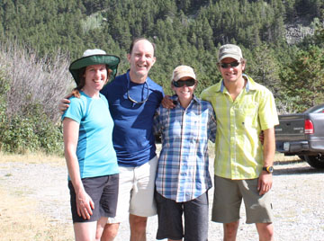
Heading home
We caravaned out along the dirt road, then drove for an hour through the hills and dales of the high plains. We had dinner at the historic Pollard Hotel in Red Lodge Montana. We bid adieu to Lisa and Andy; they started their hours-long drive back to Wyoming while we checked into the local Comfort Inn. Mike slept soundly through that night's storm.
Our reward for skipping the summit was a pleasant morning exploring the town of Red Lodge. We browsed in the bookstore, bought souvenirs in the knick-knack shops, and had lunch at a combination pizza place/Mexican restaurant. In the afternoon we drove the dramatically scenic Beartooth Highway to Cooke City, Montana, at the northeast entrance to Yellowstone National Park. We toured the park the next day.
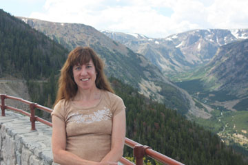
Along the Beartooth Highway
So didn't we meet the true goal of our highpointing quest? We had a lovely backcountry adventure in the Beartooth Mountains, and we visited a beautiful part of the country we might otherwise have missed. With Lisa and Andy, there's no doubt we could have made it to the summit, but how would that final mile have improved the experience? The journey is the destination. </ Mike's rationalization>