| New Mexico |
- Taos and Wheeler Peak
- Santa Fe
- Kodak Albuquerque International Balloon Fiesta
- Socorro
- South to the White Sands
- Roswell
- Carlsbad Caverns
- Guadalupe Peak, Texas
- A couple of final observations from Evelyn
| Wheeler Peak, New Mexico 13,161 feet |
Climbed 10/5/1998 |
The basic strategy for our trip to New Mexico was to work from north to south, starting in Taos and ending in El Paso Texas. We flew into Albuquerque, but drove immediately up to Taos. (Taos is "up" from Albuquerque both in elevation and in being north.) Although it was a Saturday night, the town seemed nearly deserted. At 7,000 feet, it was a little too chilly to comfortably enjoy the Mexican dinner we ate on a patio overlooking the town square, which looked a bit rundown and touristy to me. On top of that, the weather report called for increasing wind and clouds over the next few days. We decided we'd best climb Wheeler Peak the next day before the weather really got bad. All in all, not an auspicious start to the vacation.
We woke early the next day, dressed in our hiking clothes (T-shirts, long-sleeved cotton shirts or sweatshirts for layering, shorts), and set out for Taos Ski Valley. The tops of the mountains were hidden in thick gray clouds. The trees on the lower slopes were turning with fall color. When we got out of the car at the trailhead, we immediately changed into long pants and put on our coats: it was at or near freezing.
I, at least, started to warm up as we walked, but it wasn't long before we started to see a dusting of snow on the trees, then on the ground. I kept looking up at the sky, waiting for the wind to clear the clouds into the promised "scattered cloudiness." We were in the cloud cover now, an icy fog, and Evelyn was getting quite cold, especially when we stopped.
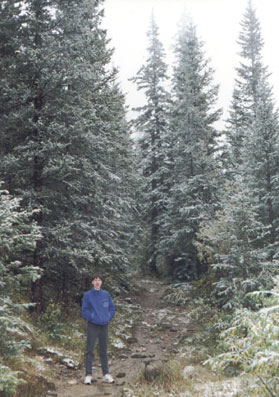
Trees brushed with snow give Evelyn doubts
The route we were following headed gradually uphill for a few miles, then followed the top of a ridge, skirting a few lower peaks before reaching Wheeler. We emerged from the trees just as we crested the ridge, and instantly felt a blast of icy cold wind blowing snow into our faces.
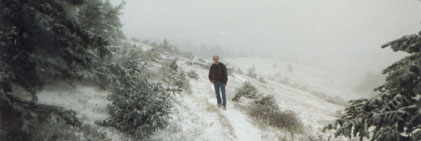
You really had to lean into the wind to walk against it, and it made our hands and faces go numb. Evelyn quickly stated the obvious: we were going to have to turn around. I resisted for a few minutes, standing behind some sheltering rocks to see if the wind would die down or blow the clouds away, but soon bowed to the inevitable. We would have to follow the ridge for a few miles. We returned the way we came.
We spent the afternoon visiting art galleries in Taos. I enjoyed them more than I had expected to. I was anticipating an overload of imitation O'Keefe and generic southwestern styles, but instead we saw a lot of very nice paintings in all varieties of styles. We did a lot of walking, but had a nice respite in the sculpture garden of the Lumina Gallery.
The next morning we visited the Taos Pueblo, the only Native American site we visited on our trip. The pueblo gave an interesting glimpse into another style of life, but during the walking tour I was distracted by the crystal clear view of the mountains and the lack of wind. Evelyn and I joked that the mountain was taunting us. It was still rather chilly, though, and Evelyn had a clear memory of her frozen fingertips from the day before.
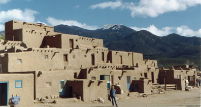
The Taos Pueblo with Wheeler Peak in the distance
The next item on our agenda was a drive around the Enchanted Circle, a scenic loop around the mountains. Just before we got to the turnoff for the drive, I asked Evelyn one last time if I could persuade her to try Wheeler Peak again. She was wholly ambivalent about it and left the decision to me. Okay then! We went back to the hotel for our warm clothes, bought cheap hats and gloves at WalMart, and returned to Taos Ski Valley.
This time we hiked a different route, one which some books listed as the primary route and others didn't talk about at all. The Williams Lake route was shorter than our previous route and started at a higher elevation. It was steeper, though. Once you reached the lake, you walked straight up a narrow pass to meet the ridge right below the Wheeler Peak summit. From reading the hiking books, I wasn't sure whether there was a defined trail up the pass, or whether it would be cross-country trailblazing.
The roads at Taos Ski Valley weren't very well marked, so it took us a while to find the trailhead. We finally set out a little after 1:00. The two-mile hike to the lake went surprisingly fast.
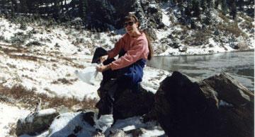
Evelyn stops by Williams Lake to put
trash bags over her socks to keep her feet dry
The weather stayed clear, and we could see Wheeler Peak right above us. The pass we had to climb looked very much like the ones I remember from Colorado, with a mix of scree, talus, and snow. I still can't say for sure whether there is a blazed trail up it, but we were able to follow a previous climber's footsteps in the snow. It was slow going, that frustrating kind of hiking where you can see the target the whole time but don't seem to be getting any closer. I started feeling hungry and a little weak about two-thirds of the way up; Evelyn had eaten some miraculous Indian bread at the pueblo, which kept her going. But we slogged it out.
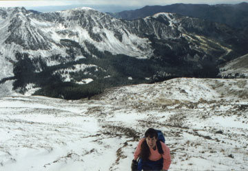
Slogging up the steep side of the mountain
When we reached the ridge, we found the same conditions as the day before—a strong face-numbing wind. There were two critical differences, though: (1) we were wearing gloves, hats, and our warmest clothes, and (2) it was only a few hundred yards to the summit. We walked the few hundred yards and rejoiced at our victory. Thankfully, the wind wasn't as strong at the summit, so we could take a few minutes for a few pictures. It was clear enough to see Colorado to the north.
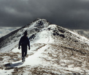
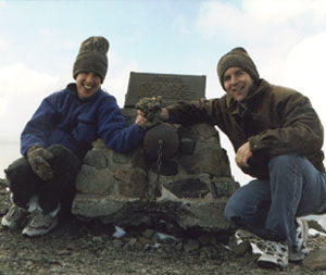
The hike down the steep pass was almost as difficult as hiking up. We couldn't slide down easily because of the mixed terrain. Soon enough, though, we were back down at the lake, warm and happy. The hike from the lake to the car seemed longer than before (doesn't it always?), but we made it back to Taos perfectly at dinner time.
We slept in a little the next day, then took our drive around the Enchanted Circle. I made an accidental detour through the Cimarron Valley, but it was at least as scenic as the rest of the loop. We made it back to Taos in the early afternoon, visited a last few shops, then continued on to Santa Fe.
| Santa Fe |
We spent just one day in Santa Fe, and we spent it all visiting galleries in and around The Plaza. Just as in Taos, I was pleasantly surprised by the range of styles and the general lack of pretension from gallery staff. I saw a lot of stuff I could imagine buying. Until our trip, I had the impression that the art market consisted solely of two extremes—overexposed popular artists like Bev Doolittle, Thomas Kincade, and Michael Parks on the one hand, and elitist postmodern museum art on the other. Thankfully, there are still plenty of artists creating accessible art that doesn't pander to the buying public, but doesn't ignore it either.
We also visited the Museum of Fine Arts, where we were impressed by an exhibit by the photographer Joel-Peter Witkin.
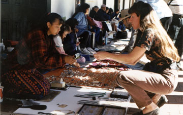
Buying earrings from an Indian artisan
outside the Palace of the Governors in Santa Fe
| Albuquerque Balloon Fiesta |
The next stop was the Kodak Albuquerque International Balloon Fiesta. If you doubt that this event is big, consider that it was the top story every night on the news. Impeaching the President? A second-class story by comparison.
Each day during the Fiesta begins with a mass ascension at dawn: hundreds of balloons inflating and taking off from Balloon Fiesta Park. So our day began with an early wake-up call and a predawn traffic jam. We got to the field just as the sun was coming up and the "special shapes" balloons were just starting to lift off. It was an all-encompassing experience, with huge, colorful, and whimsically shaped balloons rising on all sides as we wandered through the field. We'd stop every one in a while and try to figure out what the balloon ahead of us would be when filled with air. A car? A bag of groceries? A boat? Oh, I see... it's Noah's Ark!
We started snapping a million pictures, trying to capture the impressive display both on the ground and in the air. The crowd around us was doing the same. No wonder Kodak sponsors the event; there were even vendors walking around selling film.
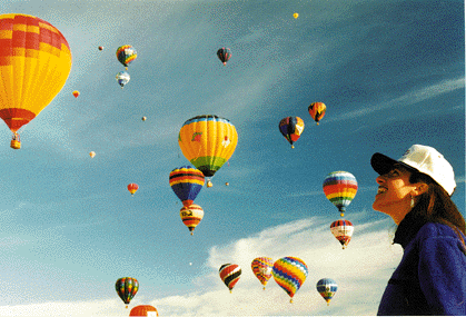
Once all the balloons were up and floating away from the park, we wandered over to the midway area for some of that fair food. Evelyn had some French Toast, and I was excited to find a booth selling those mini-donuts I loved so much at the Calgary Stampede. We checked out all of the balloon paraphernalia—the hats, the trading cards, the pins—and immersed ourselves in ballooning culture.
Meanwhile, out on the field they were having flying events. The balloons—regularly shaped this time—were swooping down one or two at a time, trying to grab a "key" off the end of a ten-foot pole someone was holding on the ground. If they grabbed the key, they got $100. The cool thing about this game was that it kept all the balloons circling the field and brought them each in turn down for a closer look.
We left in the late morning as the balloons were starting to land in the areas around the park.
After lunch we took the Sandia Peak Tramway (world's longest tramway – 2.7 miles) and hiked a bit in the mountains that rise behind Albuquerque. In the late afternoon we returned to Balloon Fiesta Park for the evening events: the "Rodeo Glow" and fireworks. In the Rodeo Glow, all the balloons inflate but stay tethered to the ground. As the sun goes down, you have the chance to see the balloons up close, collect trading cards from the balloon teams, and get the pilots' autographs. After dark, the balloons glow from inside when the pilot fires the burners. It's kind of cool, but not as neat as the morning events. We drove back to the hotel during the fireworks show.
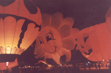
We spent one additional day in Albuquerque, but I have to say that we didn't find anything interesting.
| Socorro |
From Albuquerque we headed south, following the Rio Grande to Socorro. We made a detour west to visit the VLA (Very Large Array), the radio telescope made famous recently in the movie Contact. The VLA is on a high plain out in the middle of the desert, free from the distracting radio waves of human civilization. The site itself seemed eerily deserted too. The visitor center and guided tour were both self-service, and we didn't see anyone working in the building we walked by on the tour.
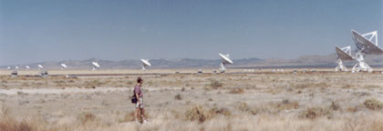
The world's most powerful radio telescope. It is an array of
27 antennas which are connected electronically to synthesize a
single radio telescope 20 miles in diameter.
I had to pick up a mail-order form to get a NRAO (National Radio Astronomy Organization) sweatshirt. I found it very interesting nevertheless. I also liked the lunch we had in a local diner in the small town of Magdelene; the makeshift decor and forgetful waiter made it seem like the place locals hang out. We stayed in a very nice Holiday Inn Express in Soccorro—I spent the late afternoon in the gym—but had the worst meal of the trip at K-Bobs.
We got up early the next day to visit the Bosque del Apache before the sun rose too high. Bosque del Apache is a wildlife refuge for birds. It is best known as the winter home for thousands of whooping cranes. We were a few weeks too early to see the crane flocks, but I really liked how the park was clearly designed with birds in mind rather than people. A gravel road circles the park, which is divided into areas for various types of bird habitats: ponds, the river, grassy wetlands, cultivated fields, and so on. There was an observation deck for each area. We saw a few birds, but it was easy to imagine the impressive display when all the wintering birds arrive. I wouldn't mind checking it out someday.
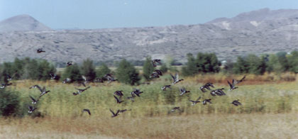
Bosque del Apache National Wildlife Refuge
| South to the White Sands |
Through the heat of the day we drove through southwestern New Mexico. Just before we reached the Texas border, we turned left and reached White Sands National Monument in the late afternoon. The White Sands are the largest gypsum dune field in the world: 278 square miles. At the southern edge where you enter the Monument, the dunes are covered with the same scrubby plants as the surrounding desert. It doesn't look very different or impressive. As you drive farther in, though, the dunes become higher, smoother, and whiter. Eventually the road itself is covered with a hard white surface, and it looks like a beach made of snow.
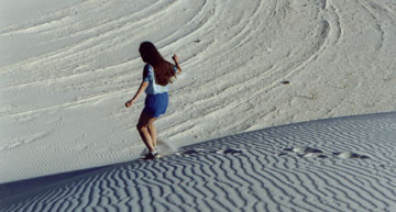
Playing on the dunes
The untracked dunes are too enticing to resist. The White Sands make a kid out of everybody. We got out of the car and ran up the "sand" to the top of a dune. From the top we looked off to see the white sand stretching in all directions, almost unbroken. Some dunes had the tops of trees or yucca plants peaking out of them. In the areas where no plants grew, we saw cool patterns made by the wind. When we dropped down between two dunes, we were enveloped by a peaceful quiet; the sand deadened all sound.
Our original plans called for camping at the park. Our guidebook talked about the dunes at night and said that camping in the one backcountry campground was the only way to see it. We had our tent and sleeping bags with us, but no backpack—and the campground was a quarter mile away over the sand. Remember what walking on sand is like? We didn't relish the idea of dragging our stuff out there. Plus we found that the park closed an hour after the sun went down.
So instead of camping, we went on a ranger-led sunset hike. We learned more about the ecology of the White Sands and Evelyn got some great pictures.
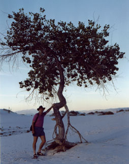
The advancing dune buries the cottonwood trees,
but the roots near the surface keep the tree's deeper
roots fed with oxygen; otherwise they would suffocate.
We spent the night in the nearby town of Alamogordo (in a room with the ice machine just outside).
We found White Sands so relaxing that we returned the next morning for an early lunch picnic.
| Roswell |
From the Tularosa Basin that holds the White Sands, we cut through the mountains to the northeast. It was strange to see (California-looking) mountain resorts so close to the desert. We made a brief stop at the disappointing Museum of the Horse in Ruidoso before driving on to Roswell.
Our motivation for visiting Roswell was, of course, its kitchy fame as the site of the Roswell Incident. In 1947, the Air Force base at Roswell (home to the crew of the Enola Gay) reported that it had captured a UFO. The next day it issued a denial of the story, which only served to fuel speculation about what had happened. These days the people of Roswell have no problem trading on their infamy: you see references to aliens and UFOs all over town. Roswell is also the site of the International UFO Museum and Research Center.
Roswell is a pretty nice town on top of all that, and a pretty big one too. We really enjoyed our stay there. The Holiday Inn Express was very nice, as was the Italian restaurant where we had dinner. We went to the movies.
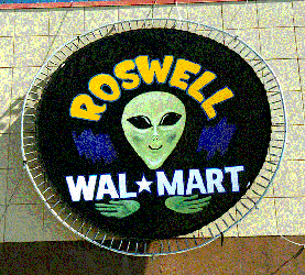
Continuing the art theme for the trip, we went to the Roswell Art Museum, where we saw an impressive exhibit of wood and stone art by Rebecca Davis and Roger Asay. We visited the UFO Museum just in time to hear the deadly serious director explain the details of the Roswell Incident to a busload of incredulous tourists, then talk to a smaller group about his personal contact with the Men in Black.
| Carlsbad Caverns |
Roswell was nice, but the reason we were in that part of New Mexico at all was 100 miles farther south: Carlsbad Caverns. Evelyn visited the caverns with her family many years ago, and she has always wanted to go there again with me.
We arrived in the town of Carlsbad in the late afternoon. We stopped outside of town at the Living Desert Museum, which turned out to be a somewhat depressing old-style zoo, made no less depressing by the fact that it was almost deserted this late in the day. (The prairie dogs sure were cute though.) We had our first trouble of the trip finding a hotel room; we managed to find one for a single night though we wanted two nights. Once we were settled in, we went right back out. We went to see the movie Antz, and I bought the Bob Dylan "Royal Albert Hall" CD.
The next morning we drove to White's City, the resort town nearest to Carlsbad Caverns, reserved a room for that night, and headed to the caverns. We spent the entire day there, and could have spent another day. The caverns are that big.
Carlsbad Caverns retains all the trapping of a true 1950s tourist attraction: the tacky billboards on the highway, the garish gift shops and overpriced motels just outside the park, a lame cafeteria-style lunch room underground in the heart of the caverns. The 50s style design of the lunch room comes complete with a stand selling Viewmaster reels! But for all that, the caverns remain very impressive.
Even though the park has elements of a tourist trap, the Park Service offers a very nice range of options for exploring the caverns—everything from an elevator-and-paved-trail route to honest-to-God spelunking expeditions requiring headlamps and a distinct lack of claustrophobia.
Evelyn and I entered the caverns through the natural entrance.
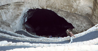
The mile and a half walk down to the Big Room provides some context that would be lacking, I think, if you took the elevator down. You see the cave getting darker and get a sense of how far down you're going. It's easier to imagine the experience of the first explorers. We had an overpriced snack at the Underground Lunch Room, then took a guided tour of the "royal" rooms (King's Chamber, Queen's Draperies, that kind of thing).
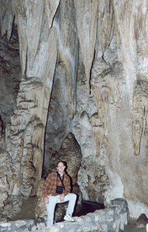
Queen's Draperies
I have to say that I was underwhelmed by most of the formations with their cute names. Yes, they were big and strange looking, but they felt prepackaged and didn't really speak to me. As we started touring the Big Room, though, I became increasingly impressed with the sheer size of the aptly named main cavern. We kept walking and walking, and the cavern kept going and going. I got disoriented, it was so big. I especially liked the areas where there were fewer formations, where the vastness was more apparent. I kept taking pictures in a futile attempt to capture how big it all was. Yeah, right; our flash barely illuminated twelve feet around us, leaving the impressive darkness looming behind. It took us all afternoon to walk around the main cavern.
I would have liked to come back the next day to try one of the guided trips to a less developed part of the cavern—not one of the trips where there's a weight limit and you can only crawl through one person at a time, but one without paved trails and recessed lighting. But all those trips either took a full day or started in the afternoon. I'll have to go back sometime.
| Guadalupe Peak, Texas 8,749 feet |
Climbed 10/15/1998 |
We awoke early the next morning to drive to the trailhead for the highest point in Texas, Guadalupe Peak. In contrast to our hike up Wheeler Peak, it was the perfect season for hiking in the Guadalupe mountains. The weather was warm but not hot, and the leaves had started to change on the north-facing slopes.
The trail approaches Guadalupe Peak from the southeast. The first section of the trail is a steep climb through typical high desert terrain. Since it was still morning, we saw a variety of wildlife, including a couple of deer on the trail right ahead of us.
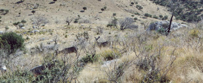
After a few long switchbacks, the trail loops around to the northwest facing side of the ridge. This side was cooler and had trees in their fall colors.
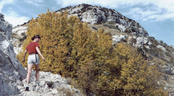
The trail contoured along just below the crest of the ridge until we came to the saddle just below Guadalupe Peak. At this point the trail crosses to the south side, where we felt more exposed but got great views of El Capitan and the badlands stretching south into Mexico. A short steep section heads straight for the summit, which is marked with a weird triangular monument to postal air carriers.
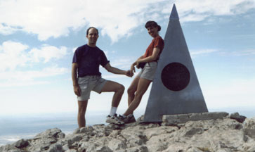
We probably spent a half hour on the summit, taking pictures, eating snacks, enjoying the beautiful day, and admiring the views both north and south. The hike back down was as pleasant as the hike up, although as usual the last mile seemed much longer than it did in the morning. We made a short stop at the Visitor's Center before heading out for El Paso.
| El Paso to Phoenix |
The drive to El Paso crossed terrain that looked a lot like the stereotypical idea of Nevada. We could see for miles in all directions; if only there had been something interesting to see! As we approached El Paso, we started asking ourselves how we should go about finding a hotel and what we would do the next day until 5:30 when our flight left for Phoenix. We started seeing signs for the airport at about 4:30, and we decided to make a dash to try to make our flight a day early. We filled the rental car with gas and headed for the Southwest Airlines desk. We didn't have time to make the 5:30 flight, but we did get on a flight an hour and a half later.
That was Thursday evening. We spent the rest of the weekend on a relaxing visit with my parents in Phoenix. In keeping with our art theme, we visited the Egyptian artifact exhibit at the Phoenix Art Museum.
| Observations from Evelyn |
After reading through the preceding account of our vacation, Evelyn said there were two observations she had made that she'd like to see noted.
- People in New Mexico are very nice and very polite, even in stressful situations like traffic jams.
- The windshield squeegees at New Mexico gas stations suck.