| Boundary Peak, Nevada 13,143 feet |
Climbed 8/22/2002 |
Our trip to Boundary Peak was a last minute substitution. We were scheduled to climb Mount Shasta with Carl Nielson, a trip that had been postponed from earlier in the summer. When we went to rent crampons, the experienced folks at the mountaineering store told us that it was probably too late in the season to attempt Shasta safely. So the three of us headed east instead.
As its name suggests, Boundary Peak is located just at the border between Nevada and California. In fact, it is a subsidiary peak of a mountain whose true summit is in California: Montgomery Peak. It was a tougher climb than we anticipated, but we managed it.
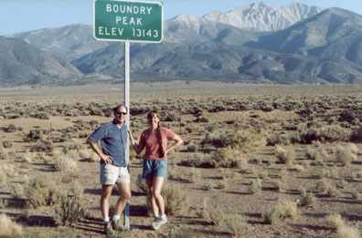
The elevation is correct, even if the spelling isn't
First, there was the dirt road to the start of the trail. I had read that it was easy to get lost in the maze of dirt roads in the area, so I had printed detailed instructions from the Web and programmed the route into my GPS receiver. With these tools we had no problem finding our way. However, we were in our Toyota Camry, and the last couple of miles really required a car with higher clearance. To avoid the huge rocks and the tall ridge in the center of the road, I had to drive on the edge, scraping the heck out of my paint job. I hit bottom or lost traction once or twice. But we made it the campsite and prayed that we would be able to make it back out.
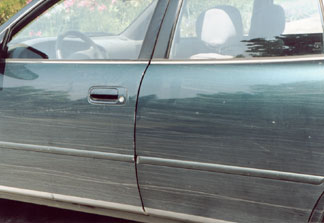
With no 4-wheel drive, we often rode the shoulder,scraping against the scrub brush
Our campsite was very nice, with a little stream running next to it. We watched the full moon rise over the mountains. In the morning, I saw the sun rise in the east.
We met up with some other hikers at the trailhead, including two guys from Atlanta who are trying to do all the highpoints. We walked with them most of the way up.
The hike consisted of one type of difficulty after another. The first hour was spent walking on a narrow trail that had sharp scratchy plants on both sides. The weather said we should wear shorts, but the plants insisted we wear long pants. The plants won the argument, so we were hot but avoided the same fate as the paint on my car.
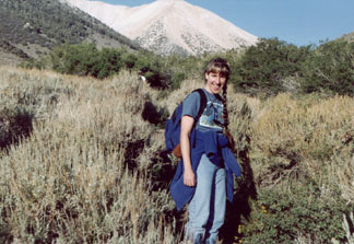
Jeans absolutely required
Once we got above 11,000 feet, the trail went straight up a very steep slope of mostly small rocks, the dreaded material called "scree." On a scree slope, you try to walk on the larger rocks, because if you try the smaller stuff, you slide back about as much as you go forward. Unfortunately, it's very hard to maintain a marked trail on a scree slope (what with the rocks moving with each step), so we frequently lost the trail. We knew we were off trail when we stopped making progress and had to "swim" against the current of stones. Two thousand vertical feet of this stuff until we finally reached the higher ridge.
During the last couple of hundred feet, I started feeling the altitude. I felt exhausted and periodically nauseous or light-headed. I was worried I might not be able to finish. But Evelyn fed me when we reached the ridge and I felt much better.
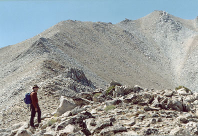
1300 vertical feet of boulder field and
an hour and a half to the summit
The good news at this ridge was that you could see the summit from there. The bad news was that it was another 1300 vertical feet higher. Through a boulder field, which means bigger rocks that you have to clamber over — at 12,000 feet, with a 3000 foot vertical drop, and we'd just recovered from a scree slope. Thankfully the trail was marked with cairns through this section.
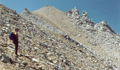
Finally we reached the summit ridge. But guess what? There's a huge rock pile sitting between us and the summit. We had to slog our way around this one last accursed obstacle before claiming victory. From the summit we could see the eastern side of the Sierras around Yosemite and a lot of Nevada desert to the east.
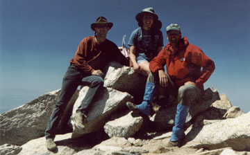
5.5 hours for Evelyn and Mike, and 3.5 hours for Carl
As a park ranger who bikes on Mount Diablo almost every day, Carl was clearly stronger than we were. He screamed ahead of us starting on the scree slope, and we didn't see him again until the summit. He was sitting on the summit for nearly two hours waiting for us.
The trip down was much easier. Scree slopes are a giant pain on the way up, but a quick route down. It took us five and a half hours to get to the summit, just two hours to get back down.
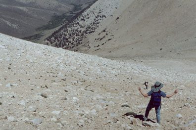
Taking a shortcut down the scree slope
The trip out on the dirt roads was easier too. During certain difficult stretches Carl ran in front of the car to clear big rocks and point out hazards. (He was well rested from his time on the summit.) We stayed the night in a motel in Lee Vining (next to Mono Lake), the nearest civilized place.