| Kings Peak, Utah 13,528 feet |
Climbed 7/7/2008 |
At 13,528 feet, Kings Peak was the tallest state highpoint that we had not yet conquered. We chose to tackle it in the summer of 2008. From route descriptions, we understood that there is a trail to the summit, making the climb closer in difficulty to Mount Whitney and Mount Elbert than to Gannett Peak or Mount Hood. In fact, the trail to Kings Peak ends at Anderson Pass, about a third of a mile and 1000 vertical feet from the summit. From that point on, it is pure boulder-scrambling with nary a cairn to be seen.
Kings Peak is in the Uintas Mountains of northern Utah. The Uintas is one of the few North American mountain ranges that runs east to west rather than north to south. Our route to the mountain approaches it from the north, which meant that we spent the night before the trip in southwestern Wyoming, not in Utah at all.
Day 1
From our hotel in Mountain View, Wyoming, we traveled via gravel road south into Utah. As we crossed the state line, the terrain changed from the high plateau of southern Wyoming to the forested foothills of the Wasatch National Forest. All told, we drove our rented SUV over 20 gravelled miles to the end of the road at Henry's Fork Campground, elevation 9430 feet. We signed the backountry register at the trailhead, adjusted our packs on our backs, and set off around 9:00 AM.
For the first five miles, the trail follows the Henry's Fork River south as it gradually gains altitude. We walked through a mixed forest of aspens and fir trees, with plenty of wildflowers blooming in the meadows. The sun was out, and the air temperature was comfortable.
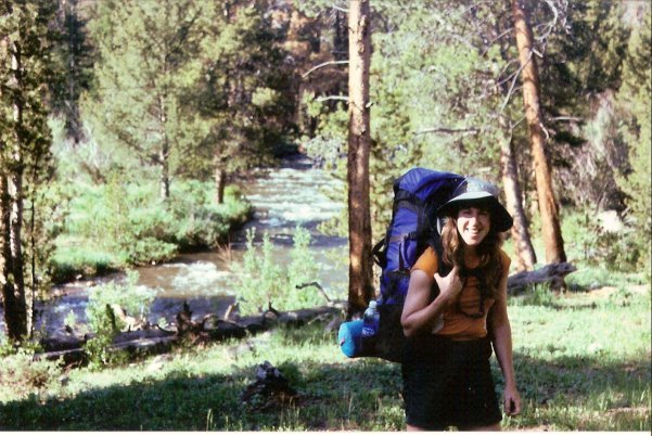
Evelyn carries her pack up the trail
About five and a half miles up the trail, we crossed the river on a log bridge, and soon after we emerged from the trees into a high-country meadow, with views of the mountains all around.
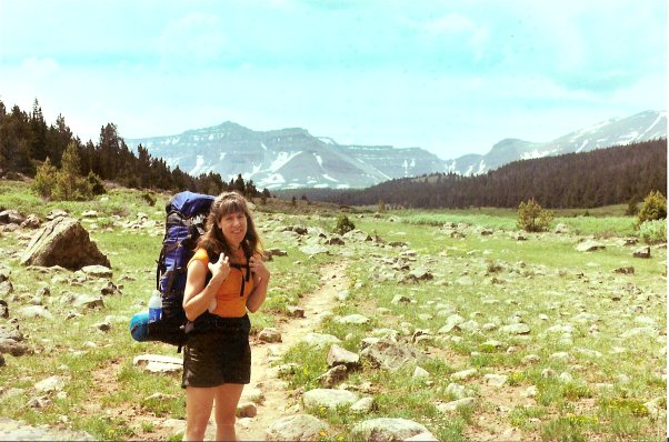
Open meadow
With afternoon approaching, the gathering clouds were promising a typical mountain afternoon thunderstorm. We picked up our pace as we crossed the open ground. As we passed along the edge of the meadow, we often had to skirt around large patches of mud or even running water on the trail. Soon enough, thunder started rumbling in the distance. We could see our destination ahead: the trees surrounding Dollar Lake. A short rain shower caught us with about a half-mile to go.
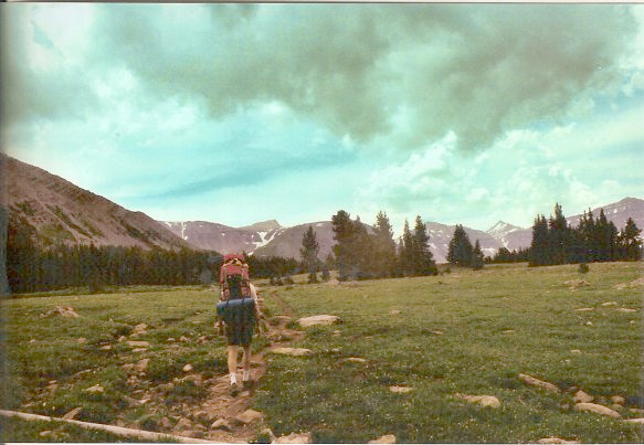
Mike hurries toward the trees under the looming sky
With the storm coming closer, we were happy to get back under the trees. We found an excellent campsite a hundred yards from the trail: flat ground under healthy trees, fallen logs nearby for sitting on, open meadow a few steps away. As we pitched our tent, we saw a glint of Dollar Lake a few hundred yards beyond: close enough to be a water source, far enough to keep the mosquito population down. The thunderstorm arrived with impeccable timing as Mike clipped on the final corner of the tent's rain fly. We listened to the rain pattering on the tent as we organized our sleeping bags inside and relaxed from our eight mile, four-hour hike.
It rained on and off for a couple of hours. When the skies cleared, we climbed out of the tent and explored our campsite. We couldn't see or hear any other campers. From the meadow we had a nice view of the lake and back down the valley from whence we came. There was a nice big rock in the middle of the meadow, the perfect size and shape to serve as our dinner table and as the place to leave our "Bear Vault," the bear-proof container holding our food and sweet-smelling toiletries. We could even see Kings Peak from our rock.
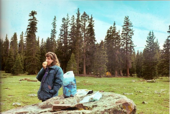
Evelyn has a snack at our table; our yellow tent is back in the trees
We had dinner (main course: cold pizza), refilled our water bottles at Dollar Lake, and organized our supplies for the next day's summit attempt. We laid down to sleep before dark. Despite the high altitude (10875 feet), we both slept very well in our cozy tent. It rained again briefly around 1:30 in the morning, but the skies were clear when Mike got out at 3:30 to go to the bathroom.
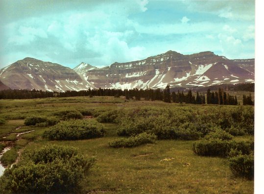
Kings Peak from our campsite (second summit from the left)
Day 2
We hit the trail at 6:00 AM after a breakfast of energy bars and fruit. From Dollar Lake, the trail climbs directly and steadily toward Gunsight Pass a thousand feet above. The sun shone on the peaks above us while leaving the valley in shadow. As we gained elevation, we could see the many lakes spread across the valley.
As its name suggests, Gunsight Pass is fairly narrow. Patches of snow covered the ends of the switchbacks leading up to the pass, so we took a more direct route up through the boulders. The wind grew steadier and colder as we ascended up the narrow gap. When we reached the top (11,888 feet), we huddled behind a big stone cairn and put on warm hats and an additional layer of clothing.
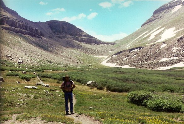
Gunsight Pass
To get to Kings Peak from Gunsight Pass, we first had to travel around the back side of another mountain, called, logically enough, Gunsight Pass Peak. The official Forest Service trail accomplishes this circumnavigation by dropping down the far side of Gunsight Pass to the base of Gunsight Pass Peak, then climbing back up to Anderson Pass on the other side. Many climbers are loathe to lose 600 feet of hard-earned elevation only to have to climb it again. These climbers have created a "use trail" (not maintained by the Forest Service) that contours around the back of Gunsight Pass Peak, heading more or less directly to Anderson Pass on the other side. We decided to take the more direct option.
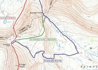
We chose the shorter green route instead of the blue "standard" route.
It takes us around the back side of the mountain to the right
in the previous picture of Gunsight Pass.
The first part of the trail clings to the steep side of Gunsight Pass Peak, up and over rocks and a few small patches of snow before flattening out at around 12,200 feet. We followed small cairns around the back of the peak.
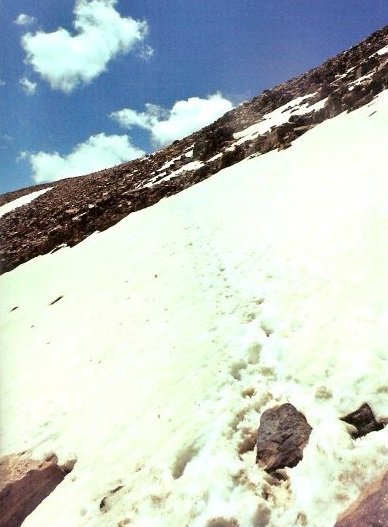
Snow and rock around the back of Gunsight Pass Peak
We could see Anderson Pass as we came around the bend. We could not, however, see where the trail intended for us to go from there. We made our own route, picking our our way through the rocks trying to stay at the same elevation as the pass.
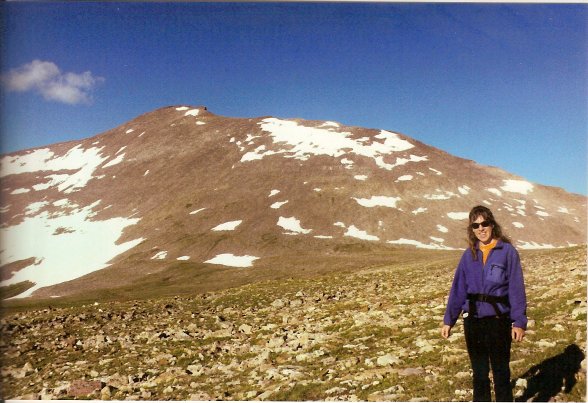
Approaching Anderson Pass, with Kings Peak in the background
We were tired by the time we reached Anderson Pass (12,700 feet). But only 850 vertical feet to go! Less than half a mile! The route description says, "From Anderson Pass, turn left and follow the ridge to the summit."
Easier said than done. The ridge in question is composed of huge boulders, with a steep drop to the right and more boulders on the left. You have to use your mountaineering savvy to pick the best path through the rock field. Choose wrong and you come up against a rock wall or a gap too wide to jump over. Watch your ankles: about one rock in every ten shifts under your feet when you step on it. Don't be fooled by the apparent high point ahead of you, the real summit lies behind it.
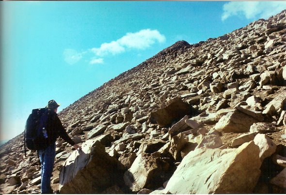
Not the real summit
After a half-hour of boulder-scrambling, Mike spotted a cairn directly above us. The cairn had something.... official-looking about it. "It's gotta be the true summit!" he thought as he headed straight uphill towards it. We reached the cairn, climbed the rocks above it, and... saw two higher summits still above us.
We reached the true summit after another exhausting half hour. It was 10:30 AM, four and a half hours from when we set out. We nervously checked the sky for any signs of an impending afternoon thunderstorm, but thankfully, the sky was clear except for a few innocent-looking clouds to the west.
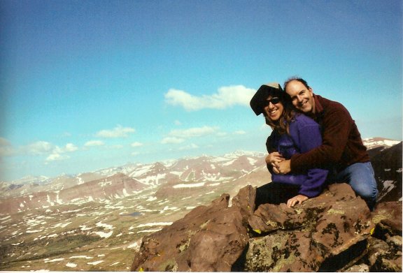
Summit of Kings Peak, 13,528 feet
We were very tired, especially of boulder-scrambling, but the trip down still lay ahead of us. We quickly snapped pictures of the panoramic view and of each other, drank water and munched some high-energy snacks, took a deep breath, and started back down.
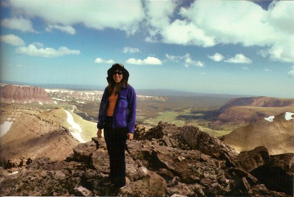
Evelyn at the summit. Our campsite is down in the valley below.
The trip down the ridge was nearly as challenging as the climb up. Eventually, we reached the trail coming down from Anderson Pass. We followed it for a ways, reveling in the soft meadow beneath our feet rather than rocks. We considered taking the official Forest Service trail back, but the prospect of extra mileage was no more attractive than it had been on the way up. We could see the cairn for the use trail above us; we decided to take the more direct route again.
Just as before, we ended up losing the trail. We reached the cairn, could not see the next one, and couldn't remember whether the trail continued higher from there. We decided to climb higher, thinking in our exhaustion that we would rather discover the trail below us than above us. Wrong. We climbed 200 vertical feet higher than we had to. Sigh. Time for yet another rest break. Where is that d*%!d trail?! We were SO happy when we finally saw the trail leading to Gunsight Pass below us. When we reached the pass, we settled down behind the cairn and enjoyed a bit of lunch. It's all downhill trail from here! The afternoon stayed clear, with no repeat of the previous day's thunderstorm.
We arrived back at our campsite about 2:00, eight hours after we left it. With the last of our depleted energy, we dropped our stuff outside the tent, took off our boots, compared blisters, and flopped down in the tent for a nap. A pleasant breeze passed through the flaps of the tent, cooling our tired bones.
We dozed for an hour or so, then Mike got up and puttered around the campsite. Looking out past our table rock, we spotted moose headed for the lake.
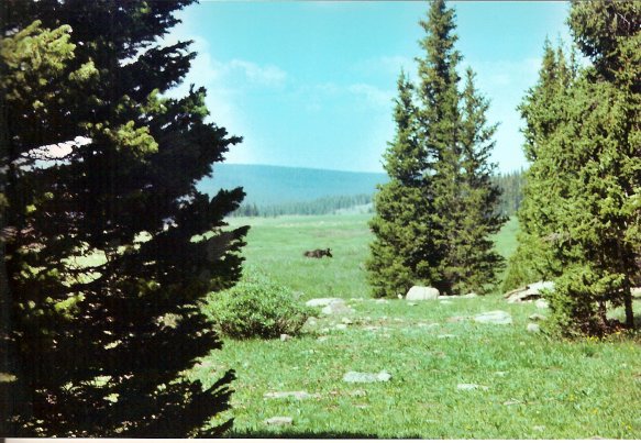
Moose! As seen from our tent
We talked about the plans for the next day: Hike out in the morning, drive to a restaurant for lunch, do some scenic driving. WHAT?! We hadn't bathed for three days, we were covered with mud from the trail, and Evelyn's windblown hair felt like a greasy bird's nest. Evelyn was NOT going to be seen in a restaurant like that. She insisted that we would need to find a hotel (more specifically, a shower) before any restaurant. Yes, good point. We had been up since 5:00 AM and had already hiked nine miles over rocks at elevation — but we had several more hours of daylight. "What's eight more miles?," said Evelyn with enthusiasm. We packed our gear, slung our heavy packs onto our backs, and set off down the trail just before 4:00 PM.
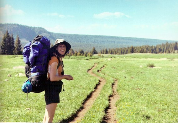
Happy (?) to be back on the trail
We returned the way we'd come: through the high meadow where the muck drove us off the trail and into the willow bushes, across Henry's Fork by the log bridge, and down into the forest. Our feet and hips were sore, but we felt like we were making good progress. When we crossed the trail leading to Alligator Lake, we knew we had just two miles to go.
As every hiker knows, the final miles of the return trip are always the longest. Our feet, legs, and hips were absolutely aching. Whenever we turned a corner, it looked like we had looped back to the beginning again. We came to landmarks that we remembered being close to the beginning of the trail. But "close to the beginning" means different things to fresh, excited adventurers than to tired, impatient mountain people bent under their heavy packs. On we trod. Just as we thought we would never reach the end before dark... we saw the parking lot! We recorded our arrival in the trail register, tossed our packs into the back of the SUV, and drove towards civilization. Total hiking time for the day: 11 and a half hours.
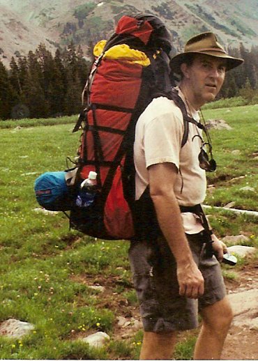
Tired after a long day on the trail
We traveled slowly along the gravel roads, since it was prime time for animals in the road (7:45 PM). We encountered a moose around one bend, and an antelope darted across the road as we crossed back into Wyoming. Back on the pavement, we drove to Interstate 80 and headed east. On the drive in from Salt Lake City, the roadside advertisements for Little America had reminded Mike about a book of the same title he had read thirty years ago. He was curious to see the glorified truck stop he vaguely remembered from the book. Little America was 20 miles east.
Little America was indeed in the middle of nowhere, with lots of trucks and RVs in the vast parking areas. The Little America Hotel looked clean and inviting with its colonial architecture and penguin statues on the roof (Wha'???). It was exactly what we needed.
Evelyn sent Mike into the hotel office by himself. When he stepped out of the car, he could barely stay upright on his cramped leg muscles. With a few stretches, he could walk with a pronounced cowboy limp. Combined with his messy hair, muddy legs, and sweat-stained back, he was surely a sight to see. They rented him a room anyway, albeit a room located in the back corner of the farthest hotel building. We lugged our packs up the stairs to our second floor room and dropped them among the faux Louis XIV-style furniture in the sitting room. The hot showers and clean sheets were a fabulous luxury after the strain of our adventure.